Grand Canyon North Rim

I have been to the South Rim of the Grand Canyon before, but never the North Rim. Since we were going to be going to so many hot and busy locations, I thought the cooler, less visited North Rim would be a great stop for us.

See? SOOO much cooler…only 90 degrees for the high! Hahahaha

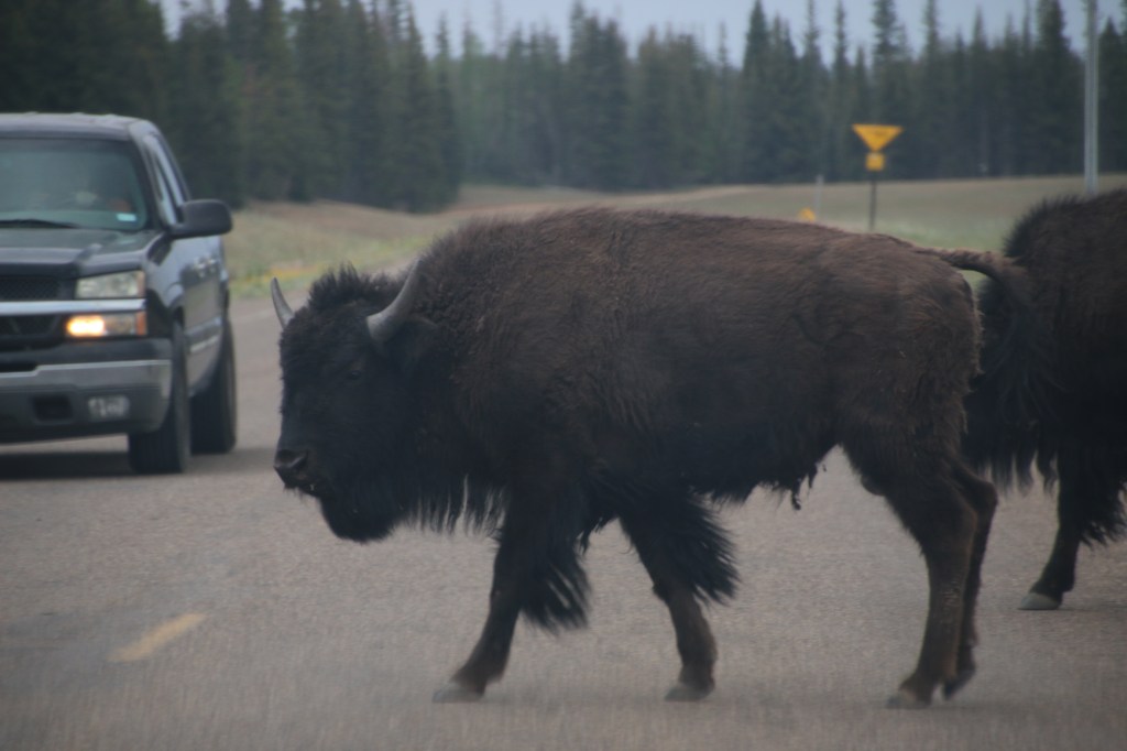
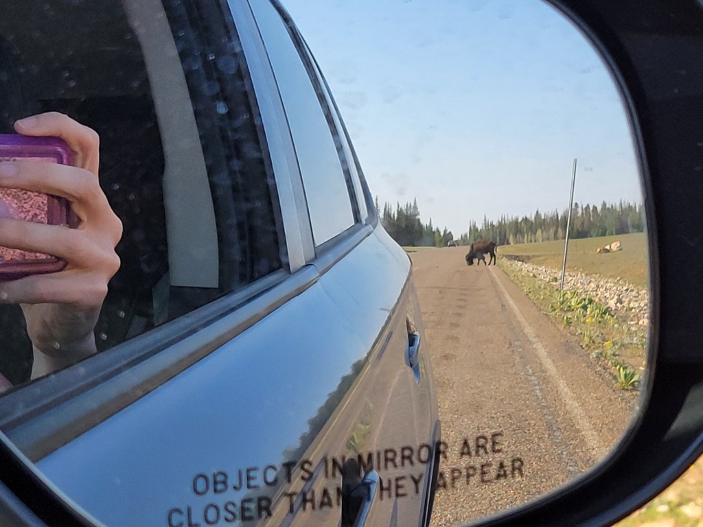
After driving past a large herd of bison, we went directly to the Visitors Center to get our passport book stamped and get our Junior Ranger books. The views we were greeted with even in the parking lot were amazing! We took a long time walking back to our car from the Visitors Center because the lot follows the rim of the canyon.

“Hey – I’m walkin’ here.” I don’t know why I hear this in my head with a New York accent….

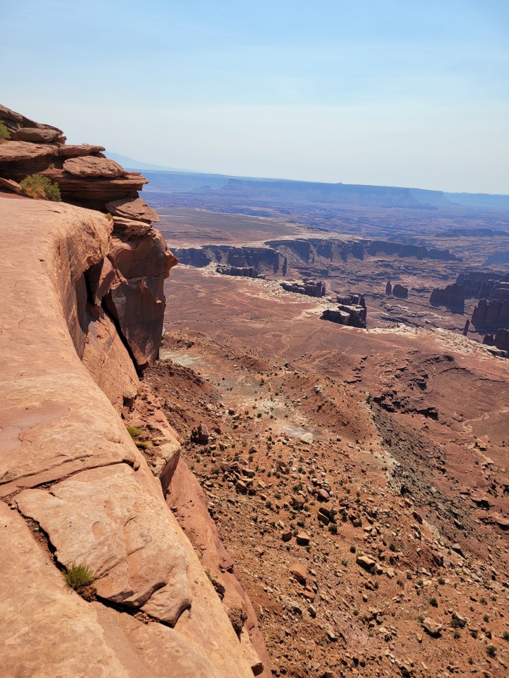
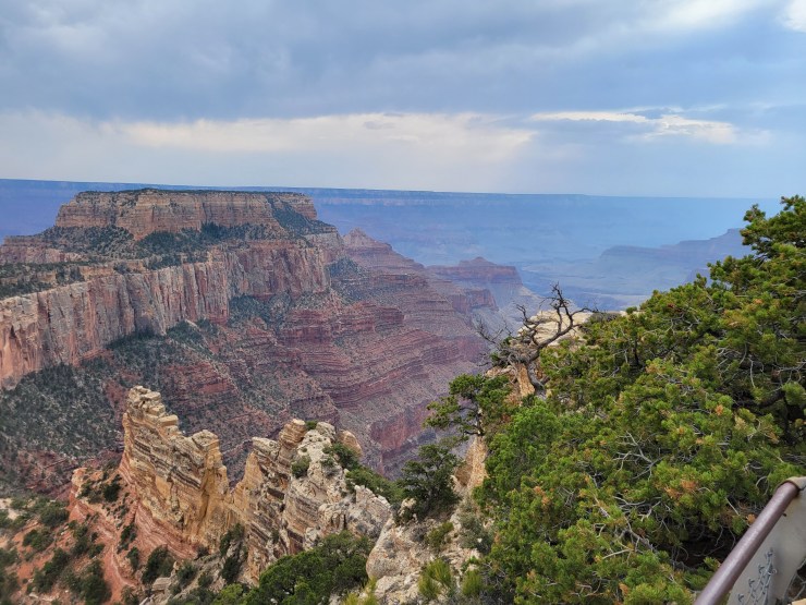
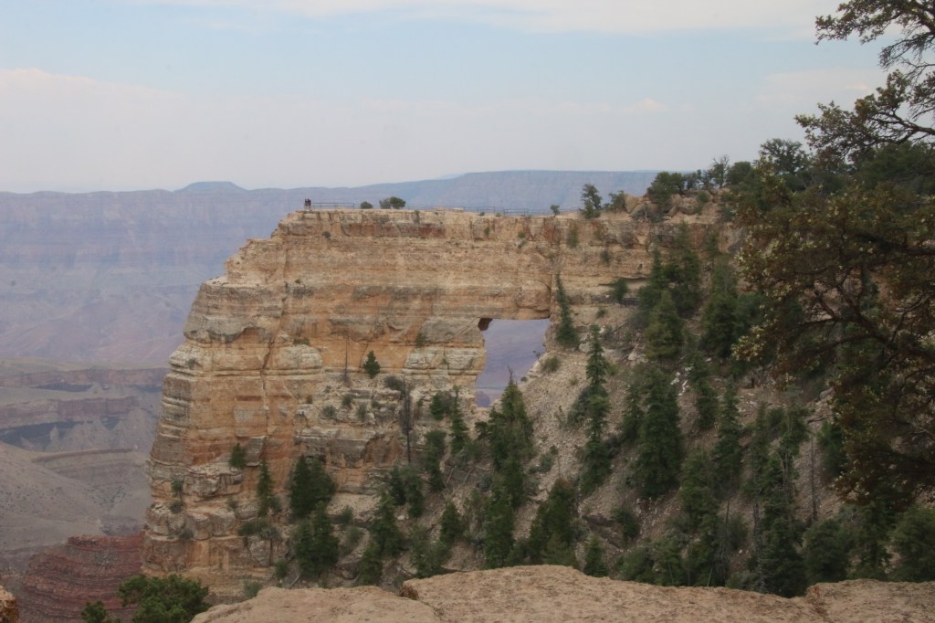
Because we were coming back again tomorrow morning for a lovely mule ride, we went to the farthest out point to get our Grand Canyon views. We drove the 23 miles out to Cape Royal. The scenic drive road ends at this point, and you can then do the 0.8 mile round trip hike to Cape Royal. It was amazing. We were the only ones at this stop (despite there being many other cars in the large parking lot). The views were amazing, the hike was super easy, and you really couldn’t ask for a better spot to enjoy the North Rim. In fact, one blog I read before we came here said there was a 270 degree view of the canyon around you, and I would have to agree with her assessment. You just don’t get that full immersion on the South Rim.

Just one of a thousand pictures I took of the view at Cape Royal!

Along this path, you can stop to walk out on the Angels Window, and there was another path that brought you to a rock perch without a railing. That view took my breath away. In fact, Hubby wasn’t keen on doing it. I went out to check it out and photograph the view, but it was so amazing, I helped the girls to come out and see it (they were seriously twitching at wanting to get out there to see it). The view was so great that I managed to coax Hubby out, too, and I think he thought it was worth overcoming his fear of heights for a brief bit. We didn’t get anywhere near the edge, but you didn’t need to be hanging off of this point to feel the canyon all the way around you. I’d share a picture from here, but the panorama picture I took doesn’t translate well in this blog.

Angels Window

We decided to head back to the hotel (which was a stage coach stop!), since we had to be up pretty early for our MULE RIDE in the morning. We got dinner at a Navajo Fry Taco truck in Jacobs Lake, and then headed back down.

The next morning, we drove back up to the North Rim, and said good morning to our buffalo friends again.

Good morning, Buffalo!

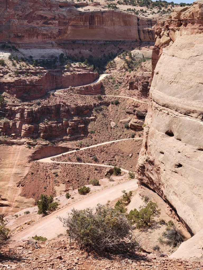
It was time for our mule ride. We checked in at the Grand Canyon Lodge and waited for our shuttle to take us to the trailhead. There was a hilarious man from Oklahoma who was going on the mule ride with his daughter. He kept talking about how Wormy and Squid were going to show him up on their mules. When we got off the shuttle, we arrived at the holding area for the mules. We got introduced to the mule we would be riding – the cowboys asked us how much horse riding experience we had and then paired us up with a mule appropriate for our level of skill. Wormy got a sweet little mule called Pumpkin, Squid’s was named Leslie, I got Bill, and I can’t remember what Hubby’s mule was named. It wasn’t long before we were off. For those reading this and trying to figure out whether it is a good idea for them, know that the mule does this thousands of times a year, and does it all without any help from you. Worry’s mule had a rope, and the lead cowboy held her rope the whole time, so no worries if you have little kids. They took great care of her.

Here we go!

The rules for mule riding were to keep your mule close to the one in front of you and not to let them snack. Well, I learned I stink at mule riding, because good ‘ole Bill was not in the mood to keep up with the tour. The funny Oklahoma guy was behind me, and I swear his mule was honking at me & Bill to get moving. However, I will say listening to Mr. Oklahoma’s southern accent made me feel like I was in a Wild West movie. Oh, and did I mention that Bill likes to snack more than I do?!? I didn’t know that was possible…it was like we were in the Mule Taco Bell line or something. Regardless of this, I may not have been the worst mule rider of the group, as there was another young girl on the tour with us who lost her shoe while riding her mule. I don’t know how that happens – Bill was snacking at the time while I begged him to follow the rules. We took the 1-hour mule trip, thinking this would be great for us first-timers, and it was perfect. Our butts were a little sore afterwards, but we had a lot of fun. We mainly went through the first area, but we definitely had glimpses of the canyon at a few stops as well. I had read about how people who take mules into the canyon sometimes get nervous because they feel like they will fall off the path or the mule, and we didn’t have much of that to worry about on our tour.

View from my mule, Bill (he’s probably snacking on tree bark while I took this)

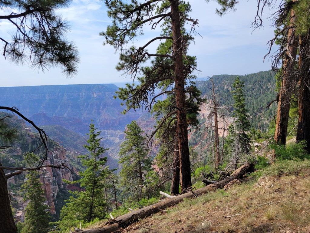
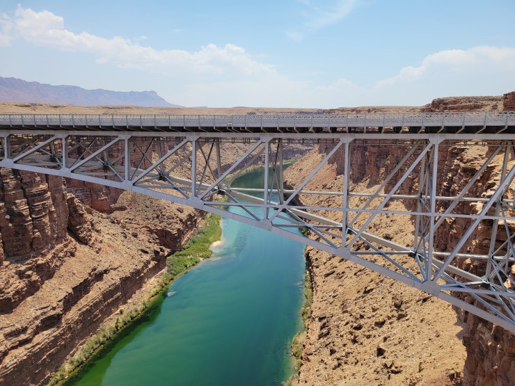
After our mule ride, we were going to eat lunch at the Grand Canyon Lodge, as the views were awesome there (floor to ceiling windows facing the canyon), but they weren’t open until dinner. Instead we sat in the dining room and looked out, and then hiked out the path from the lodge patio that leads to Bright Angel Point. The North Rim was such a different experience from what I had experienced at the South Rim. I had read that only 10% of all people who visit the Grand Canyon make it to the North Rim. If you are ever able to do it, I highly recommend the North Rim – so relaxing and peaceful compared to its southern lay neighbor. I also read that to hike the North Rim to the South Rim, it is only 21 miles, but to drive it is 220 miles (4.5 hours, in case you are curious).

Final views of the North Rim

Horseshoe Bend and Navajo Bridge

Our next stop on our big trip was Horseshoe Bend. Some good friends of ours had done an amazing boat tour of the Glen Canyon Dam and Horseshoe Bend, but we were not as lucky. All of the boat tours were shutdown still due to Covid, so we had to settle for a walk out at the viewpoint.

When you arrive at the parking area for Horseshoe Bend, you have to pay $10 to park – this is not an entrance fee, but rather a parking fee, so your National Park Passes do not work here. Once you park, there are signs letting you know that there is very little shade on the walk, and that it is 1.5 mile round trip hike. We didn’t find it particularly difficult, and there were two shaded stops on the walk for those who needed it.

A beautiful view awaits those who do the hike

We really enjoyed the hike – it wasn’t overly difficult for my 7-year old, 11-year old, or me & hubby. The views were beautiful, and people watching was entertaining, too, as people posed like they were falling off of rocks (terrifying!). It was also fun to look down and see how tiny the boats looked.

You know you are getting close to the overlook when you see the line of people!

After spending some time enjoying the views here, we were off. Our ultimate destination for the day was the North Rim of the Grand Canyon, but I had another leg stretch planned for after lunch (which we ate in Page, AZ). We stopped at the Navajo Bridge (we had to cross it anyway) that is a part of Glen Canyon National Recreation Area. The bridge is known to have California Condors hanging out at it, and is a big deal due to the fact that the bridge helped people cross the Colorado River. Before this bridge was put into place in 1929, people had to travel 800 miles around to cross the river. That’s crazy! Thank goodness for this bridge, or we probably wouldn’t be visiting the North Rim!

The bridge on the left is the pedestrian bridge (it was the original). The bridge on the right is now the one that cars cross (it has a better weight limit and is wider than the first bridge).

There is a parking lot and visitors center at this spot (and bathrooms!). You can walk out on the pedestrian bridge and get some views of the gorgeous Colorado River. The California Condors like to hang out underneath the bridge, so if you ever get here be sure to look for nests.

California Condor chilling in the shade

The view is beautiful, and it’s a nice quick stop between Horseshoe Bend and Grand Canyon North. We certainly enjoyed it!

The Colorado River is so pretty!

Canyonlands National Park

Day 3 of our trip – we got up nice and early, and got on the road since we were staying 45 minutes away from Arches National Park. That was supposed to be our first stop of the morning. We arrived at Arches at 8:30 am. You are probably thinking “hey, why are you talking about Arches when the post is supposed to be about Canyonlands?” Well, sadly, it is because Arches had a big ‘ole sign at the entrance telling everyone that the park was closed due to being at capacity, and we should try to come back in 3-5 hours. Apparently, 8:30 in the morning is not considered early at Arches! Hubby went onto the Arches Twitter account and read that the park actually closed not long after 7:30 am. That’s crazy to me!!! So, we decided to continue following the Arches Twitter account and flipflop our order for the day – which meant we were off to Canyonlands instead (thank goodness they are only 40 minutes apart)! We went to the Islands in the Sky section exclusively.

Once in Canyonlands, after hitting the Visitors Center, we drove out to see the Upheaval Dome and Whale Rock. We stopped at few amazing scenic overlooks and pull offs to enjoy the view. We were going to do the Mesa arch hike, but the lot looked super busy, and I really wanted to hike at Arches with the girls. Because of the heat and the fact that Arches was now going to be in the hottest part of the day, I knew I had to pick carefully. Instead, we drove out to Grand View Point Overlook and hiked around the rim. It was crazy to stand on the edge of those cliffs. Unfortunately, the pictures don’t even come close to the feeling of being on the edge of the earth that you get standing at this viewpoint!

I tried to get the edge I was standing on as a way to gauge the drop off…still doesn’t even come close to the feeling of being on that edge 6,000 ft up

We had a lot of fun hanging out in that area, and I’m glad we went all the way down. Hubby and I had been to Canyonlands for a brief jaunt before, so we had to hit our favorite spot from last visit – the very first view in the park: Shafer Canyon Overlook. There’s a nice little path that takes you down some stairs to get to a landing that sticks out into the canyon. Last time this was our first view – this time, it was our last view! The girls and I went out to the edge of the rock formation in search of the shade of the rocks (more work but great rewards), while Hubby stayed on a little more solid ground. We just sat on the rocks and thought about how lovely the views were.

My view from my rock seat in the shade. 🙂

The girls noticed a road down the side of the canyon, so we had a blast watching everyone go up and down those crazy dirt roads. I’m pretty sure if I would have recommended going down that road, my entire family would have thrown me off the cliff after yesterday’s adventures! Hahaha.

Looks fun to me! 😉

After that, Hubby checked out his Twitter feed and saw that Arches was accepting visitors again, so we hightailed it out to get to Arches! Until next time, Canyonlands!

Capitol Reef National Park

Well, after the bust at the slot canyons earlier, we were off to Capitol Reef National Park. I was really excited to see this park, as I wanted to see the Pioneer Register (and redeem myself).

We drove the entire length of the Scenic Drive (which definitely lived up to its name)!. Where the road ends, there is a dirt road turnoff for the Capitol Gorge. Due to our last experience on a dirt road, you can imagine my hubby’s look at me as we made this turn. However, it was a MUCH shorter excursion.

A much more scenic dirt road!

We drove in and around these rock formations and enjoyed the view until the road ended at the trailhead parking lot. Then it is just a 0.5 mile easy hike to get to the Pioneer Register.

Thank goodness for flat, shaded hikes!

Just as I was about to doubt myself and thought we might have missed it (since my confidence was definitely shaken), we came across another family and they told us it was just ahead. In fact, right next to them was a sign saying that the area was under camera surveillance. I thought this was odd, until I saw that we were at the Pioneer Register, and the National Park Service was deterring other people from adding their own graffiti to the wall. It was really neat to look at these old signatures that are still on the walls today. The people stood in their wagons and carved (or in some cases SHOT) their names on the walls of the rock.

Standing in the same exact spot as this person from 1888.

The scenery around Capitol Reef was gorgeous. My only regret in this park is that we didn’t get there early enough to have pie from the Gifford House. More unfinished business in Utah, I guess! 🙂

View from the front seat of the rental car. Sometimes it just doesn’t get any better than this!

Bryce Canyon – Home of the Hoodoos

Our next stop on the tour of Utah’s Big Five National Parks was Bryce Canyon. We got into Bryce, Utah the night before, and were super excited to find breakfast included with the hotel (Bryce Canyon View Lodge). Even better – it was a hot breakfast buffet!!! Woohoo! All of the chain motels/hotels had stopped breakfasts due to Covid, so this was our only included meal for the whole trip. I’m not sure if my excitement is coming through or not – I’m talking FOOD here!

Anyway, the reason that was all relevant was because it meant we got a later start getting into the park. By later, I am talking 8:30 am. This is noteworthy, because we went to the parking lot for the Navajo Loop trailhead, and it was full. We did several laps, but no luck at all. We were too late to be part of the early crowd, but too early to catch anyone leaving. I was bummed, but I suggested we ditch the crowd and do the farthest out point in the park – Bryce Point. We drove out there (seeing the Prairie Dog burrows on the way), and it was significantly less busy. This spot was breathtaking. We got out of the car and walk out to the lookout, and the view really did take my breath away.

Our first view of hoodoos!
Though there was plenty of altitude, we only felt the air a little thinner when we were exerting ourselves – no altitude sickness!

We then drove to Inspiration Point, which was equally stunning. This point required a little longer of a walk to get to an observation area that jutted out over the canyon. We spent quite awhile at this stop – watching birds soar, walking around the rim trail, looking down at people hiking at the bottom, etc. It was crazy to think that we weren’t all that far from Zion, but the views were so drastically different!

Along the rim trail at Inspiration Point

After we had thoroughly enjoyed the views here, it was time to try our luck at the Navajo Loop trailhead again. However, the girls did learn through their Junior Ranger books that Ponderosa Pines smell like vanilla and butterscotch in the cracks of their bark. I’m sure the other tourists enjoyed watching our family sniffing tree bark on the way back to the car! By the way – in case you were wondering, they really do smell delicious! So…anyway….back to the first stop we went. And, of course – no spots. To make matters worse, now the lot was blocked off so that you couldn’t keep doing slow laps around to find a spot. We decided to give up and save the hike for another trip. We definitely got to see the amazing hoodoos and enjoyed the views we had. Until next time, Bryce Canyon!

Zion National Park

After flying into the Las Vegas airport, and visiting the Valley of Fire, we visited at Zion National Park. To be honest, I was a little intimidated by this park. During the months of February through November, the only way to get into the depths of Zion are through shuttle bus. Up until two weeks before we left, the park was using tickets to control the number of people riding the shuttle. They had just discontinued that system, but I knew that attendance was up at every national park in the area. The other thing that worried me was that the main parking lot for the shuttles is the Visitors Center lot. If you do not get a spot in that lot, you must park in paid lots in the nearby town (Springdale) and ride a shuttle bus to the park shuttle bus route. The town’s shuttle bus system only runs until 6 pm. Since the hike I really wanted to do was the farthest stop on the park shuttle system, I was worried about enjoying my time in the park while watching the clock. The whole reason I enjoy national parks is because there is no sense of time (normally) while I am enjoying gorgeous views or fun hikes! And then there’s that hot weather I’ve been mentioning….

My fears were not necessary, however. Because of the time change between Valley of Fire and Zion not being in our favor, we arrived at Zion at 2:30 pm. This actually worked out well, since many people left in the afternoon due to the heat – we had many spots in the Visitors Center lot to choose from. By the time we visited the bathrooms, refilled water, scoped out the Visitors Center area, and such, there was a park system shuttle waiting for riders (no line!). We hopped on (masks required), and rode all the way out to the Temple of Sinawava. We wanted to do the Riverside Walk (2.2 mile) trail to the beginning of the Narrows. Most of the other stops were actually closed due to large rockfalls, so this was one of the only hikes that we had on our list that was still open.

The buses waiting to pick people up from the Temple of Sinawava stop

The Riverside Walk was fantastic – none of the members of my family complained about the length, as the walk was on mostly paved, smooth paths, and there was a lot of shade to be had. There were plenty of beautiful views of the river and the big rock walls the whole way. You could also see waterfalls and hanging gardens. Then, when we got into the river for the section of the Narrows we did, the girls had such a blast! They loved the cold water and the fun of trying to walk anywhere (my husband wasn’t so sure…hahaha).

Lovely shaded walk
Look at this view!

Though we really, really enjoyed the views from the Riverside Walk and the Narrows, we also loved the drive out of the park. You are allowed to drive your car on the Zion-Mount Carmel Highway, which goes off to the East from the park. If you are headed to any of the other national parks in Utah, there is a good likelihood that you have to go this way anyway. You get to drive up the East Rim through a series of switchbacks and tunnels.

This drive brings you to the East entrance to the park, which was pretty backed up at the time we went through.
This is not the big tunnel, but a cute little tunnel through this beautiful wavy rock!

We loved all of the canyon views and the Checkerboard Mesa. There was definitely so much to see in Zion, and we hope that next time we go, the rockfalls will not limit what we can see/do! This was one of my favorite stops in our trip because of how amazing the views were everywhere you looked!

Checkerboard Mesa

Valley of Fire State Park

Finally! A return to travel! We had airline credits from our canceled trip last summer that had to be used by September, so we decided to head to the Southwest. In hindsight, it seems a trip to the desert in summer may be a questionable idea, but it’s even better when there is record heat and drought conditions! It was HOT!

Our first stop was a beautiful state park in Nevada – Valley of Fire State Park. We came in from Las Vegas, and it was 45 minutes or so away, and a very easy drive. We arrived on a Sunday midmorning, and there wasn’t a line to get in, and didn’t seem very busy.

Since we came in from the west, our first stop was the Beehives. The girls had a lot of fun climbing into the caves to find cooler spots in the shade. This spot gave a great view of the surrounding area.

Beehives – with plenty of hiding holes to find shade in for curious kids!

Next we hit up the Atlatl Rock, which is definitely worth the climb – the petroglyphs to be seen here were very easy to locate and view.

You’ve got this!
We had fun making up stories for these petroglyphs!

Next, we were off to our hike for the morning – we did the Fire Wave hike. It was roughly 0.7 mile hike to the Fire Wave. Though this one is undoubtedly not as immense as the super famous Fire Wave in Vermilion Cliffs, it was so much more accessible for us (no ticket system, significantly shorter hike). It was a very hot hike, however, as there isn’t much for shade after the first 1/4 mile. It was quite a sight to see, however! You can continue on the trail past Fire Wave, or you can turn around and head back to the parking lot (like we did). Interestingly enough, the trail closed a few days after we were there due to a high risk of heat-related illness!

So pretty and swirly! Who knew rocks could do that?!?
Wormy is using her Dad as a ‘shade tree.’

After this, we were going to hike the White Dome area and pink canyon, but I really tired out Wormy and Squid, so they were not interested in this idea at all! We drove around the White Domes area, and then headed out to drive the rest of the park.

Near the Elephant Rock/Visitors Center area

I highly recommend a stop to Valley of Fire State Park. It was quiet, calm, and peaceful. Usually we experience similar environment at national parks, but with the uptick in visitors to most of them, this was a nice change!