Petrified Forest National Park

Petrified Forest National Park in Arizona was our last planned national park on our Southwest trip, and the one I knew the least about. This park is laid out really nicely – if you were short on time, or not into hiking, you can see the majority of it from your car. We like to get right up in each park, though, so I’ll share what we did in case it helps.

We stopped at the Painted Desert Visitors Center first, and this was the first visitors center that we actually were permitted to enter! There was a ranger that greeted everyone and kind of gave us the rundown of the whole park – highlights and spots to definitely stop at. After we got our Junior Ranger stuff, we were off to explore.

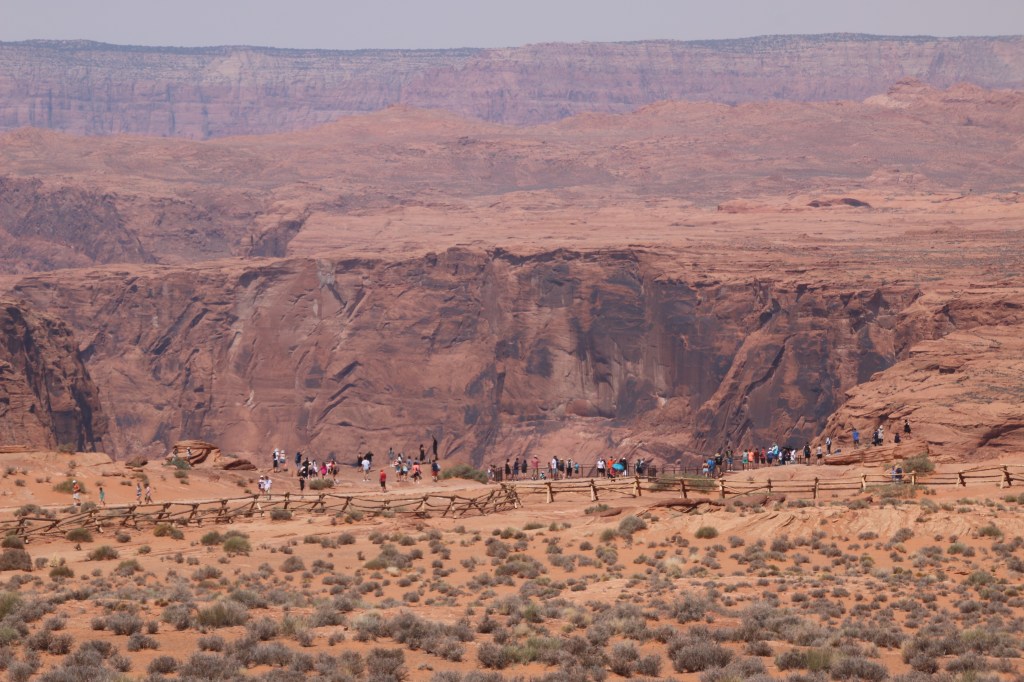
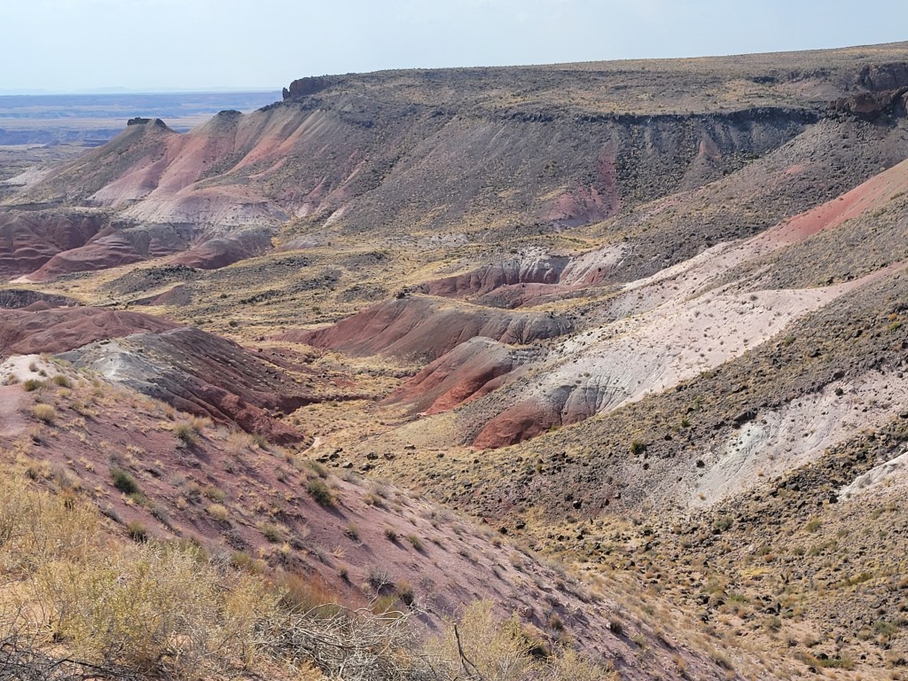
Our first stop was to view the Painted Desert Inn Historic Landmark, along with a great view of the Painted Desert. This stop is really nice for parking the car, hopping out, getting some pictures, and hopping back in.

The Painted Desert View off of a short path from the parking lot at Painted Desert Inn
Painted Desert Inn – now a museum. We did not go in to explore, as we wanted to do a few hikes in the park instead.

We continued driving the loop to more views of the Painted Desert, stopping at some of the many pull offs and exploring the views.

Beautiful colors in the Painted Desert

As we left the Painted Desert area, we crossed where the Route 66 used to travel. It was marked with an old 1932 Studebaker sits, and you can see the freeway that replaced Route 66 right behind it.

Is that my car???

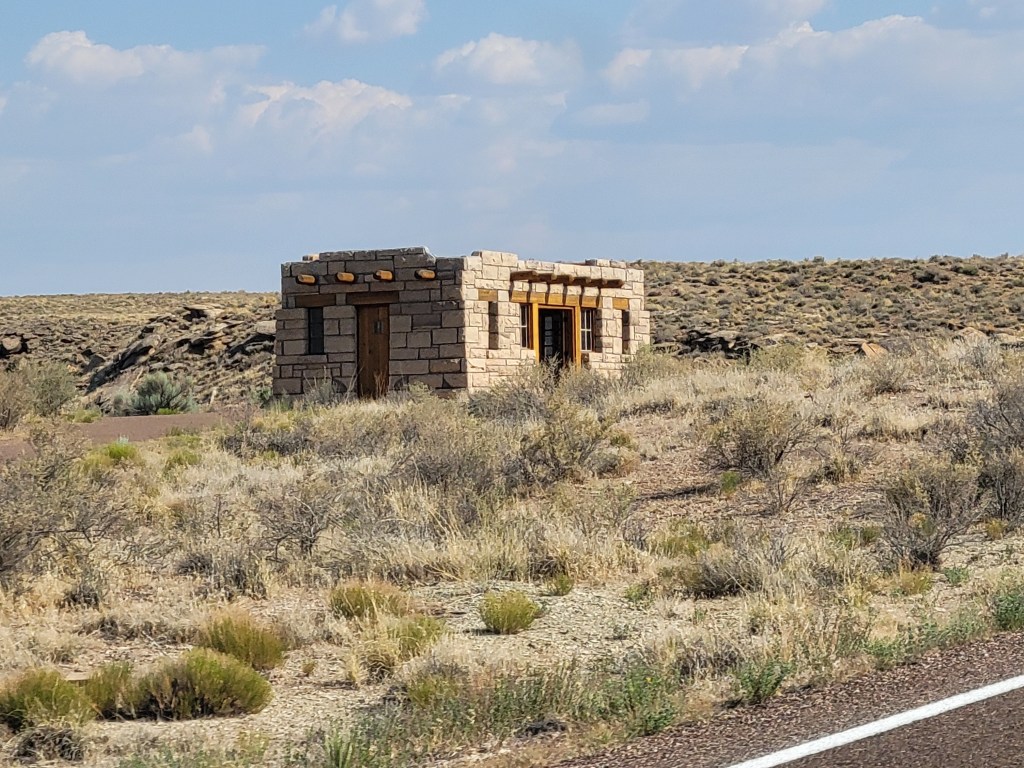
You then cross underneath I-40 and enter a different feel to the park. There are roughly 26 more miles to travel on the road that goes through the whole park, and the view gets very different. The first stop to see in this section is Puerco Pueblo, which shows an example of an old Pueblo home. We just drove by this one to see it from the outside.

Puerco Pueblo….looks comfy…or not.

The next stop we made was to Newspaper Rock, which is a collection of petroglyphs. This was the biggest collection of petroglyphs (the brochure boasts over 650 from over 2000 years ago!) I had seen on our trip so far, and the park had many binoculars present for people to look through to view the petroglyphs closer. My camera has a nice zoom, so we used that to look at, as well.

There is a lot going on at this stop…this isn’t the half of it!

Next up in the park was a section called the Teepees, because the rock formations look like teepees. There are several pull offs along the road to view them, or you can see them as you drive.

Behold – a Teepee!

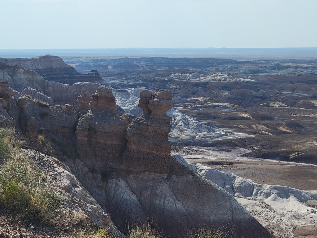
The next part of our trip was my favorite – the ranger at the visitors center recommended the Blue Mesa Trail, and I had read about this before coming as well. It is a 1.0 mile loop trail that takes you down into these beautiful blue-ish rock formations. To get to this trail, you have to take one of the only roads off of the main park road to get to the parking lot, and it is a 3.5 mile loop road to get there, but it does not take long before you have arrived. When you get out of your car, you can tell from the view that it is going to be pretty epic. You have to hike down into the formations (while reminding yourself that each time you go down, you must come up at some point….), but it wasn’t a horrible descent (or ascent later). The views were definitely worth it! All four of us loved this hike, and highly recommend it!

Even if you don’t hike the Blue Mesa Trail, the view from the parking lot and overlook are fantastic!
We loved the park’s sense of humor (read the small print under the cloud)!
This is as I was hiking down into the formations. They were so pretty! You felt like you were in a different world!

There are many samples of petrified logs along the trail, and even a really big one that Wormy and Squid had fun looking at. However, the best petrified log viewing was still to come.

Wormy and I hopped out at the Agate Bridge stop farther down the main park road, and this was definitely another hop out and back in stop. There’s a petrified log serving as a bridge, along with some nice views of the area.

110 foot long petrified log serving as a bridge

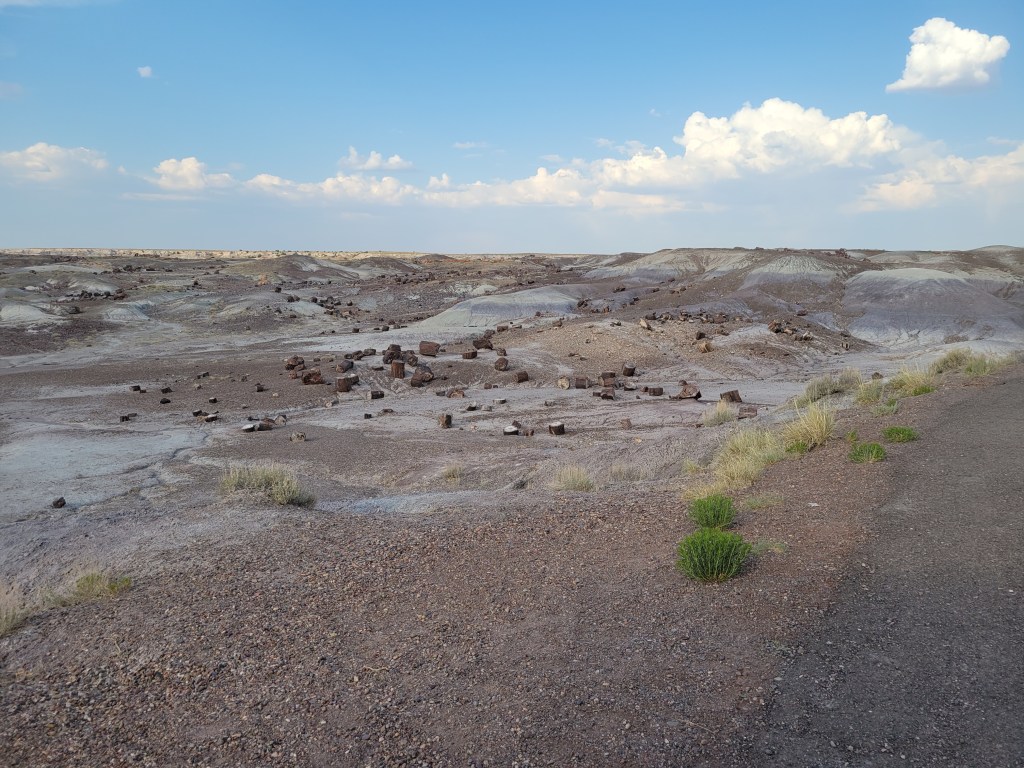
Our next stop was the Crystal Forest – this was another really neat hike. There are so many pieces of petrified wood hanging out with no trees in sight – it really makes you wonder what life was like in this exact location thousands of years ago. Luckily, there are plenty of signs to tell you the answer to that question! Crystal Forest is a paved 3/4 mile trail. I don’t think we did all of it – we kind of looked at logs that interested us, checked out a nice overlook of the whole area, and wandered around as much as we wanted.

Logs, logs, everywhere you looked!

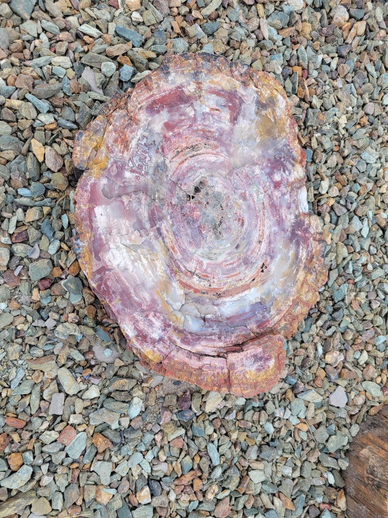
Our final fun stop in the park was all the way at the end of the park road near the Rainbow Visitors Center. It was the Giant Logs Trail – this 0.4 mile loop trail is filled with the park’s biggest petrified log (named “Old Faithful”), along with the most colorful logs of the park. They were so gorgeous to look at. When I planned this trip, I have to be honest – I did not know very much at all about petrified logs. I imagined moldy chunks of wood littering a forest area. I had no idea how pretty petrified logs are or how they formed.

This one was my favorite! Old Faithful was nice to see, but I preferred looking at all of the colorful pieces of wood!

As you leave the park, there is a checkpoint to make sure no one is stealing the petrified wood. I am saddened to think people would be that self-centered, but glad that they check so that there are plenty of beautiful things for everyone to see!

Up close and personal with the stripes of this petrified log

Grand Canyon South

After hanging out at the North Rim for awhile, it was time to visit the most popular spots of the Grand Canyon. We drove in from the East entrance, and stopped at Grandview Point for the girls’ first glimpse of the view from the South. Hubby had let us out to get the views while he circled for a parking spot, as it was pretty busy. This spot has a nice lookout, and then stairs going down to a trail with a rock ledge to stand out on. It was the perfect first stop for the girls!

View from our spot sitting on the ledge off of the trail at Grandview Point

Next, we drove in to the Visitors Center area, which had changed A LOT from when I was here last – it looked like the park entrance of Disney World with all of the multiple lots and shuttle buses stops! I realize it’s been since 2008 since Hubby and I went, but whoa! Like all of the other parks we had been to on this trip, they had the Visitors Center stuff (maps, junior ranger badges, etc) all outside so no one had to enter a building due to Covid. After we picked up what we needed, we decided to go into Tusayan and check into our hotel/get dinner (some of us were getting hangry…).

After dinner, we went back into the park to check out Yaki Point. We were back to the Visitors Center area to walk out to Yaki Point. Surprisingly, there weren’t very many people around anymore. I think the fact that it was cloudy so there wasn’t going to be an epic sunset sent people packing early.

View from the Yaki Point overlook

We continued around the rim for awhile, looking for even quieter spots to enjoy the canyon from. It was neat watching the light change, even without the sun being out. It was also nice having the canyon to ourselves from the spots we found.

A lovely spot we found to just sit on a rock and enjoy the blue hues coming out. I also found this little tree growing out of the rock very inspirational – if it can persevere and grow off the side of this rock, I can fight through anything, too!

After the lovely views, we walked back to the car to go back to the hotel for some swimming. While we were walking, we saw a deer super close to us. The funny thing was so many people were walking right by and didn’t even notice! They thought the only sights to see were the ones that happened at the viewpoints and overlooks!

Well, hello there…

The next morning, we got up and headed for some shopping first at the Market Plaza, as Wormy badly wanted a Night Sky book. We walked around the rim trail for a bit, and enjoyed watching the hikers down below in the canyon!

Beautiful view on a beautiful day!

Next, it was off to take the shuttle to Hermits Rest. We had a driver who took her job very seriously – the girls still joke about her a little, as she would yell at people to get out of her way (so they would hear her…as I tried to explain to the girls), and she was very serious about everyone keeping their masks on while on the shuttle. She discouraged people from going all the way out to Hermits Rest because she said it would be hard to get a seat on the shuttle for the return trip and she always hated turning away families with small children in this heat. Hubby and I glanced nervously at each other, but decided to stick with our plan to go all the way out.

We got off at Hermits Rest and walked a distance past the building to get some beautiful views, while everyone who was on the shuttle with us stopped in the building. Once the crowd had passed, we went back into the building for some shopping and to buy the girls some fruit popsicles. They totally hit the spot, but the girls had to finish them before getting on the shuttle. The fruit popsicles were nice and thick, so it took them awhile!

When it was time to go, we did not have any problem getting a seat on the shuttle that was waiting, so we were relieved that the first bus driver’s prediction did not hold true for us. I think the girls really enjoyed the Grand Canyon, but really – what’s not to like???

View from Hermits Rest – the trail past the building

Arches National Park

We finally made it into Arches National Park! It was roughly 2:00 by the time we got in and parked at the Balanced Rock trailhead/viewpoint. It was really hot, but we were not new to this by now!

The trail that goes around Balanced Rock is super easy and only 0.3 miles long. It provides a 360 view of the rock formation itself, and a nice view of the area surrounding it.

Balanced Rock – kind of looks like a sculpture I did in art class once…

After enjoying Balanced Rock, we decided to head farther into the park to the Delicate Arch viewpoints and then come back to the arches you can sit/climb on. I thought the girls might enjoy that as a grand finale. We drove out to the shared parking for the Upper and Lower Delicate Arch viewpoints. Everyone was stopping at the lower viewpoint and calling it a day, but we went for the upper viewpoint. This was a longer hike and a bigger climb, but nothing compared to the 3 mile hike out to the actual arch itself (which there was no way my family was up for in this heat!). The hike itself was 1 mile round trip, though my watch had it as slightly longer than that from the actual parking lot. There is a lot of climbing of stairs, as it is called the UPPER viewpoint for a reason. However, I thought the view was better and worth the climb. Squid and Wormy weren’t in agreement.

This view of Delicate Arch is a super-zoomed in view from my camera phone – so sorry for the quality.

After climbing back down, we drove back through the park to get to the Windows Section of the park. I couldn’t seem to convince anyone in the car with me to explore the “Fiery Furnace” viewpoint (not the trail itself!)….they seemed to think everything so far had been a Fiery Furnace, so they had a hard time believing a stop there was necessary. I gave in, and guided us to the Windows and Turret Arches. When Hubby and I had been here last, this was our favorite section of the park. The arches are huge, and the trails take you into the arches. Some of my favorite photos of my husband and I from that trip came from this area. The girls were hesitant at first, but they loved it after we got going.

Coming up to North Window Arch from the trail.

We stopped at the North Window arch first and enjoyed the view from sitting on the arch itself. We had somehow managed to lose the crowd (I say that as though it was like Disney World or something…it was nowhere near that bad…just a clump of people to avoid). We had a lovely view looking out over the park.

Just sitting on the arch and looking out at the park.

Next, we decided to skip South Window Arch, as the clump of people had caught up to us and were headed that way. Instead, we hopped over to Turret Arch. The arches are all labeled on the path, so you can easily pick and choose which way to go. It’s also a bit of a loop, so you can also change your mind and jump back to an arch you skipped really easily as well. The whole trail is 1 mile, with a few stairs. If you choose to explore Turret Arch, there is a bit of climbing up some rocks to get into the arch, but the view (and the feeling of conquering an arch) is totally worth it. That arch is my favorite.

We sat and looked up at the arch above us and enjoyed the peace of the park. Even in the heat, it was a very reflective spot.

After the fun of these arches, it was back to the parking lot. You’re even treated to a beautiful view of the Garden of Eden section of the park on the way back to your car. My family was starving by this point, so we went into Moab for dinner, and head off to set ourselves up for our next adventure for tomorrow.

Hiking back to the parking lot and the Garden of Eden is in the background.

Grand Canyon North Rim

I have been to the South Rim of the Grand Canyon before, but never the North Rim. Since we were going to be going to so many hot and busy locations, I thought the cooler, less visited North Rim would be a great stop for us.

See? SOOO much cooler…only 90 degrees for the high! Hahahaha

After driving past a large herd of bison, we went directly to the Visitors Center to get our passport book stamped and get our Junior Ranger books. The views we were greeted with even in the parking lot were amazing! We took a long time walking back to our car from the Visitors Center because the lot follows the rim of the canyon.

“Hey – I’m walkin’ here.” I don’t know why I hear this in my head with a New York accent….

Because we were coming back again tomorrow morning for a lovely mule ride, we went to the farthest out point to get our Grand Canyon views. We drove the 23 miles out to Cape Royal. The scenic drive road ends at this point, and you can then do the 0.8 mile round trip hike to Cape Royal. It was amazing. We were the only ones at this stop (despite there being many other cars in the large parking lot). The views were amazing, the hike was super easy, and you really couldn’t ask for a better spot to enjoy the North Rim. In fact, one blog I read before we came here said there was a 270 degree view of the canyon around you, and I would have to agree with her assessment. You just don’t get that full immersion on the South Rim.

Just one of a thousand pictures I took of the view at Cape Royal!

Along this path, you can stop to walk out on the Angels Window, and there was another path that brought you to a rock perch without a railing. That view took my breath away. In fact, Hubby wasn’t keen on doing it. I went out to check it out and photograph the view, but it was so amazing, I helped the girls to come out and see it (they were seriously twitching at wanting to get out there to see it). The view was so great that I managed to coax Hubby out, too, and I think he thought it was worth overcoming his fear of heights for a brief bit. We didn’t get anywhere near the edge, but you didn’t need to be hanging off of this point to feel the canyon all the way around you. I’d share a picture from here, but the panorama picture I took doesn’t translate well in this blog.

Angels Window

We decided to head back to the hotel (which was a stage coach stop!), since we had to be up pretty early for our MULE RIDE in the morning. We got dinner at a Navajo Fry Taco truck in Jacobs Lake, and then headed back down.

The next morning, we drove back up to the North Rim, and said good morning to our buffalo friends again.

Good morning, Buffalo!

It was time for our mule ride. We checked in at the Grand Canyon Lodge and waited for our shuttle to take us to the trailhead. There was a hilarious man from Oklahoma who was going on the mule ride with his daughter. He kept talking about how Wormy and Squid were going to show him up on their mules. When we got off the shuttle, we arrived at the holding area for the mules. We got introduced to the mule we would be riding – the cowboys asked us how much horse riding experience we had and then paired us up with a mule appropriate for our level of skill. Wormy got a sweet little mule called Pumpkin, Squid’s was named Leslie, I got Bill, and I can’t remember what Hubby’s mule was named. It wasn’t long before we were off. For those reading this and trying to figure out whether it is a good idea for them, know that the mule does this thousands of times a year, and does it all without any help from you. Worry’s mule had a rope, and the lead cowboy held her rope the whole time, so no worries if you have little kids. They took great care of her.

Here we go!

The rules for mule riding were to keep your mule close to the one in front of you and not to let them snack. Well, I learned I stink at mule riding, because good ‘ole Bill was not in the mood to keep up with the tour. The funny Oklahoma guy was behind me, and I swear his mule was honking at me & Bill to get moving. However, I will say listening to Mr. Oklahoma’s southern accent made me feel like I was in a Wild West movie. Oh, and did I mention that Bill likes to snack more than I do?!? I didn’t know that was possible…it was like we were in the Mule Taco Bell line or something. Regardless of this, I may not have been the worst mule rider of the group, as there was another young girl on the tour with us who lost her shoe while riding her mule. I don’t know how that happens – Bill was snacking at the time while I begged him to follow the rules. We took the 1-hour mule trip, thinking this would be great for us first-timers, and it was perfect. Our butts were a little sore afterwards, but we had a lot of fun. We mainly went through the first area, but we definitely had glimpses of the canyon at a few stops as well. I had read about how people who take mules into the canyon sometimes get nervous because they feel like they will fall off the path or the mule, and we didn’t have much of that to worry about on our tour.

View from my mule, Bill (he’s probably snacking on tree bark while I took this)

After our mule ride, we were going to eat lunch at the Grand Canyon Lodge, as the views were awesome there (floor to ceiling windows facing the canyon), but they weren’t open until dinner. Instead we sat in the dining room and looked out, and then hiked out the path from the lodge patio that leads to Bright Angel Point. The North Rim was such a different experience from what I had experienced at the South Rim. I had read that only 10% of all people who visit the Grand Canyon make it to the North Rim. If you are ever able to do it, I highly recommend the North Rim – so relaxing and peaceful compared to its southern lay neighbor. I also read that to hike the North Rim to the South Rim, it is only 21 miles, but to drive it is 220 miles (4.5 hours, in case you are curious).

Final views of the North Rim

Horseshoe Bend and Navajo Bridge

Our next stop on our big trip was Horseshoe Bend. Some good friends of ours had done an amazing boat tour of the Glen Canyon Dam and Horseshoe Bend, but we were not as lucky. All of the boat tours were shutdown still due to Covid, so we had to settle for a walk out at the viewpoint.

When you arrive at the parking area for Horseshoe Bend, you have to pay $10 to park – this is not an entrance fee, but rather a parking fee, so your National Park Passes do not work here. Once you park, there are signs letting you know that there is very little shade on the walk, and that it is 1.5 mile round trip hike. We didn’t find it particularly difficult, and there were two shaded stops on the walk for those who needed it.

A beautiful view awaits those who do the hike

We really enjoyed the hike – it wasn’t overly difficult for my 7-year old, 11-year old, or me & hubby. The views were beautiful, and people watching was entertaining, too, as people posed like they were falling off of rocks (terrifying!). It was also fun to look down and see how tiny the boats looked.

You know you are getting close to the overlook when you see the line of people!

After spending some time enjoying the views here, we were off. Our ultimate destination for the day was the North Rim of the Grand Canyon, but I had another leg stretch planned for after lunch (which we ate in Page, AZ). We stopped at the Navajo Bridge (we had to cross it anyway) that is a part of Glen Canyon National Recreation Area. The bridge is known to have California Condors hanging out at it, and is a big deal due to the fact that the bridge helped people cross the Colorado River. Before this bridge was put into place in 1929, people had to travel 800 miles around to cross the river. That’s crazy! Thank goodness for this bridge, or we probably wouldn’t be visiting the North Rim!

The bridge on the left is the pedestrian bridge (it was the original). The bridge on the right is now the one that cars cross (it has a better weight limit and is wider than the first bridge).

There is a parking lot and visitors center at this spot (and bathrooms!). You can walk out on the pedestrian bridge and get some views of the gorgeous Colorado River. The California Condors like to hang out underneath the bridge, so if you ever get here be sure to look for nests.

California Condor chilling in the shade

The view is beautiful, and it’s a nice quick stop between Horseshoe Bend and Grand Canyon North. We certainly enjoyed it!

The Colorado River is so pretty!

Canyonlands National Park

Day 3 of our trip – we got up nice and early, and got on the road since we were staying 45 minutes away from Arches National Park. That was supposed to be our first stop of the morning. We arrived at Arches at 8:30 am. You are probably thinking “hey, why are you talking about Arches when the post is supposed to be about Canyonlands?” Well, sadly, it is because Arches had a big ‘ole sign at the entrance telling everyone that the park was closed due to being at capacity, and we should try to come back in 3-5 hours. Apparently, 8:30 in the morning is not considered early at Arches! Hubby went onto the Arches Twitter account and read that the park actually closed not long after 7:30 am. That’s crazy to me!!! So, we decided to continue following the Arches Twitter account and flipflop our order for the day – which meant we were off to Canyonlands instead (thank goodness they are only 40 minutes apart)! We went to the Islands in the Sky section exclusively.

Once in Canyonlands, after hitting the Visitors Center, we drove out to see the Upheaval Dome and Whale Rock. We stopped at few amazing scenic overlooks and pull offs to enjoy the view. We were going to do the Mesa arch hike, but the lot looked super busy, and I really wanted to hike at Arches with the girls. Because of the heat and the fact that Arches was now going to be in the hottest part of the day, I knew I had to pick carefully. Instead, we drove out to Grand View Point Overlook and hiked around the rim. It was crazy to stand on the edge of those cliffs. Unfortunately, the pictures don’t even come close to the feeling of being on the edge of the earth that you get standing at this viewpoint!

I tried to get the edge I was standing on as a way to gauge the drop off…still doesn’t even come close to the feeling of being on that edge 6,000 ft up

We had a lot of fun hanging out in that area, and I’m glad we went all the way down. Hubby and I had been to Canyonlands for a brief jaunt before, so we had to hit our favorite spot from last visit – the very first view in the park: Shafer Canyon Overlook. There’s a nice little path that takes you down some stairs to get to a landing that sticks out into the canyon. Last time this was our first view – this time, it was our last view! The girls and I went out to the edge of the rock formation in search of the shade of the rocks (more work but great rewards), while Hubby stayed on a little more solid ground. We just sat on the rocks and thought about how lovely the views were.

My view from my rock seat in the shade. 🙂

The girls noticed a road down the side of the canyon, so we had a blast watching everyone go up and down those crazy dirt roads. I’m pretty sure if I would have recommended going down that road, my entire family would have thrown me off the cliff after yesterday’s adventures! Hahaha.

Looks fun to me! 😉

After that, Hubby checked out his Twitter feed and saw that Arches was accepting visitors again, so we hightailed it out to get to Arches! Until next time, Canyonlands!

Capitol Reef National Park

Well, after the bust at the slot canyons earlier, we were off to Capitol Reef National Park. I was really excited to see this park, as I wanted to see the Pioneer Register (and redeem myself).

We drove the entire length of the Scenic Drive (which definitely lived up to its name)!. Where the road ends, there is a dirt road turnoff for the Capitol Gorge. Due to our last experience on a dirt road, you can imagine my hubby’s look at me as we made this turn. However, it was a MUCH shorter excursion.

A much more scenic dirt road!

We drove in and around these rock formations and enjoyed the view until the road ended at the trailhead parking lot. Then it is just a 0.5 mile easy hike to get to the Pioneer Register.

Thank goodness for flat, shaded hikes!

Just as I was about to doubt myself and thought we might have missed it (since my confidence was definitely shaken), we came across another family and they told us it was just ahead. In fact, right next to them was a sign saying that the area was under camera surveillance. I thought this was odd, until I saw that we were at the Pioneer Register, and the National Park Service was deterring other people from adding their own graffiti to the wall. It was really neat to look at these old signatures that are still on the walls today. The people stood in their wagons and carved (or in some cases SHOT) their names on the walls of the rock.

Standing in the same exact spot as this person from 1888.

The scenery around Capitol Reef was gorgeous. My only regret in this park is that we didn’t get there early enough to have pie from the Gifford House. More unfinished business in Utah, I guess! 🙂

View from the front seat of the rental car. Sometimes it just doesn’t get any better than this!

Slot Canyon…or not…

I was super excited to see a slot canyon – I’ve been looking at amazing pictures at Antelope Canyon for over a decade now, and I had done a lot of research on where we can find an easily accessible slot canyon since Antelope Canyon is still closed due to Covid.

Enter Peek-a-boo Slot Canyon. Reviews said it was the most accessible slot people have been to. There were pictures of young kids scrambling up the entrance. Someone even was quoted as saying ‘this was grandma’s favorite hike.’ Sounded like a win to me.

I did all the appropriate research, printing out word descriptions, tracking where we’d go on Google Earth, everything. We even stopped at the visitor’s center before going and got the official map to the slot. You’d think we couldn’t screw this up. Or could we?

Where does this road even go?!?!

Well, the drive to the trail is a 26-mile dirt ride adventure on a road that they call ‘washboard.’ Though we did have a rental, we still were not keen on losing a wheel, so hubby took it slow. It took us about an hour. We found the parking lot for the trailhead, and the area looked like a scene out of a Wile E. Coyote cartoon. Desolate desert every way we looked. Despite the 118 degree temperatures, I was determined. We started in on the trail, and I set my watch to make sure I could keep track of our distance traveled.

“Looks so inviting,” said no one

We were following the trail very well, and saw some nice desert views, if you’re into that kind of thing (my family was not). Eventually we came to a marker that marked the rim trail going to the right and the slots were to the left. I went to the left of the sign and continued on the path. After going about a mile, we realized we must have missed a turn, as we were still up on the rim. Unfortunately, I didn’t know where we went wrong, so we turned around. At this point, Wormy (after having declared “I hate the desert” a half mile in) is crying. I was pretty sure that was only going to make her feel more dehydrated (don’t worry; we brought the camelback with us).

Once we got back to the sign from before, we realized we needed to scramble down a pretty hefty rocky ledge in order to get to the slots. The path we followed was the people who must have looked at that and said “heck, no” and kept on toward the rim trail. It didn’t help that the area below was fenced off. I didn’t see that there was an opening in the fence until I looked closer.

Unfortunately, by this time we had gone 2 miles in the brutal heat, so I couldn’t afford to drag my family through another mile just to get to the slot canyon, plus a mile back (assuming we didn’t get lost again!). I was so disappointed in myself. This was what I had hoped to be the highlight of the trip, and instead I ended up torturing my family. Ugh.

On the way back to the car (Dad of the Year carrying Wormy out)

Bryce Canyon – Home of the Hoodoos

Our next stop on the tour of Utah’s Big Five National Parks was Bryce Canyon. We got into Bryce, Utah the night before, and were super excited to find breakfast included with the hotel (Bryce Canyon View Lodge). Even better – it was a hot breakfast buffet!!! Woohoo! All of the chain motels/hotels had stopped breakfasts due to Covid, so this was our only included meal for the whole trip. I’m not sure if my excitement is coming through or not – I’m talking FOOD here!

Anyway, the reason that was all relevant was because it meant we got a later start getting into the park. By later, I am talking 8:30 am. This is noteworthy, because we went to the parking lot for the Navajo Loop trailhead, and it was full. We did several laps, but no luck at all. We were too late to be part of the early crowd, but too early to catch anyone leaving. I was bummed, but I suggested we ditch the crowd and do the farthest out point in the park – Bryce Point. We drove out there (seeing the Prairie Dog burrows on the way), and it was significantly less busy. This spot was breathtaking. We got out of the car and walk out to the lookout, and the view really did take my breath away.

Our first view of hoodoos!
Though there was plenty of altitude, we only felt the air a little thinner when we were exerting ourselves – no altitude sickness!

We then drove to Inspiration Point, which was equally stunning. This point required a little longer of a walk to get to an observation area that jutted out over the canyon. We spent quite awhile at this stop – watching birds soar, walking around the rim trail, looking down at people hiking at the bottom, etc. It was crazy to think that we weren’t all that far from Zion, but the views were so drastically different!

Along the rim trail at Inspiration Point

After we had thoroughly enjoyed the views here, it was time to try our luck at the Navajo Loop trailhead again. However, the girls did learn through their Junior Ranger books that Ponderosa Pines smell like vanilla and butterscotch in the cracks of their bark. I’m sure the other tourists enjoyed watching our family sniffing tree bark on the way back to the car! By the way – in case you were wondering, they really do smell delicious! So…anyway….back to the first stop we went. And, of course – no spots. To make matters worse, now the lot was blocked off so that you couldn’t keep doing slow laps around to find a spot. We decided to give up and save the hike for another trip. We definitely got to see the amazing hoodoos and enjoyed the views we had. Until next time, Bryce Canyon!

Zion National Park

After flying into the Las Vegas airport, and visiting the Valley of Fire, we visited at Zion National Park. To be honest, I was a little intimidated by this park. During the months of February through November, the only way to get into the depths of Zion are through shuttle bus. Up until two weeks before we left, the park was using tickets to control the number of people riding the shuttle. They had just discontinued that system, but I knew that attendance was up at every national park in the area. The other thing that worried me was that the main parking lot for the shuttles is the Visitors Center lot. If you do not get a spot in that lot, you must park in paid lots in the nearby town (Springdale) and ride a shuttle bus to the park shuttle bus route. The town’s shuttle bus system only runs until 6 pm. Since the hike I really wanted to do was the farthest stop on the park shuttle system, I was worried about enjoying my time in the park while watching the clock. The whole reason I enjoy national parks is because there is no sense of time (normally) while I am enjoying gorgeous views or fun hikes! And then there’s that hot weather I’ve been mentioning….

My fears were not necessary, however. Because of the time change between Valley of Fire and Zion not being in our favor, we arrived at Zion at 2:30 pm. This actually worked out well, since many people left in the afternoon due to the heat – we had many spots in the Visitors Center lot to choose from. By the time we visited the bathrooms, refilled water, scoped out the Visitors Center area, and such, there was a park system shuttle waiting for riders (no line!). We hopped on (masks required), and rode all the way out to the Temple of Sinawava. We wanted to do the Riverside Walk (2.2 mile) trail to the beginning of the Narrows. Most of the other stops were actually closed due to large rockfalls, so this was one of the only hikes that we had on our list that was still open.

The buses waiting to pick people up from the Temple of Sinawava stop

The Riverside Walk was fantastic – none of the members of my family complained about the length, as the walk was on mostly paved, smooth paths, and there was a lot of shade to be had. There were plenty of beautiful views of the river and the big rock walls the whole way. You could also see waterfalls and hanging gardens. Then, when we got into the river for the section of the Narrows we did, the girls had such a blast! They loved the cold water and the fun of trying to walk anywhere (my husband wasn’t so sure…hahaha).

Lovely shaded walk
Look at this view!

Though we really, really enjoyed the views from the Riverside Walk and the Narrows, we also loved the drive out of the park. You are allowed to drive your car on the Zion-Mount Carmel Highway, which goes off to the East from the park. If you are headed to any of the other national parks in Utah, there is a good likelihood that you have to go this way anyway. You get to drive up the East Rim through a series of switchbacks and tunnels.

This drive brings you to the East entrance to the park, which was pretty backed up at the time we went through.
This is not the big tunnel, but a cute little tunnel through this beautiful wavy rock!

We loved all of the canyon views and the Checkerboard Mesa. There was definitely so much to see in Zion, and we hope that next time we go, the rockfalls will not limit what we can see/do! This was one of my favorite stops in our trip because of how amazing the views were everywhere you looked!

Checkerboard Mesa